Feeds:
Posts
Comments

Posts Tagged ‘Zambales’

Hermana Mayor, Zambales

Carlo has written affectionately about the Sisters of Zambales.  I myself first learned about them from fellow Omni pilots Mark from Tennessee and Mike from Hong Kong.  They had spied on the beauties from the air.  Then they were invited to do a touch and go on the elder sister, and they let me peek at the cellphone pictures they took.


Mike Foggo's camera, Jan 2, 2007


I am, of course, talking about the Hermana islands.  Carlo and I have overflown the islands, and have posted several aerial photos of the Hermanas here.

Both are privately owned.  Hermana Mayor is owned by a very private family long associated with aviation.  Then a member of the family, a fellow pilot and a real gentleman, invited me to fly to the island for a brief visit in October 2008.


Bucao river delta at Botolan, Zambales
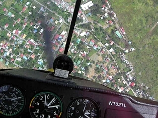
We flew through cloudy skies near Mt. Pinatubo, then along the Bucao river valley west of Pinatubo’s crater. 

The Bucao river drains its lahar-choked waters into the South China sea at Botolan, Zambales. 


Busy Subic Bay, formerly a major US naval base in the Pacific, lies south of Botolan.  We followed the coastline north to Iba, a historical World War II fighter airstrip, now an important training airfield in western Luzon. 

Airport at Iba, Zambales


When World War II started in the Philippines on December 8, 1941, Iba had the only radar station in the Philippines.  The US 3rd Pursuit Squadron was based here, tasked with protecting Clark Field from aerial assault.  Iba lasted all of one day, wiped out by the first Japanese bombing raid on December 8.

North of Iba stretches one of the most beautiful coastlines in the Philippines, rivaling that of the Ilocos Sur and Ilocos Norte provinces.  

Palauig bay, Zambales

Masinloc Bay Prince  

Palauig and Masinloc bays are like surreal art where watercolor has stained the painting in incredible shades of azure and blue, with underwater coral formations clearly visible from the air.


Finally we approached the Hermana Islands.  Hermana Menor, also with its own airstrip, is 2.5 nautical miles directly west of the headland at Santa Cruz, Zambales.

Hermana Menor


Nearly four nautical miles northwest lies Hermana Mayor.  My first impression was, Wow, that’s a pretty airfield!  Manicured like a golf fairway, with a well-marked 1,000-meter x 60-meter grass runway. 

Hermana Mayor


Coming in from over water, I had to focus on the runway edge and ignore the optical illusion that I was about to land on the sea short of the runway.

Turning final at Hermana Mayor


I began to notice details — the main house, the breakwater protecting the runway end, stretches of dazzling white beaches.  Self-confident as they are, pilots can’t walk on water, so I kept the power on during the approach. 

Power-on final approach to Hermana Mayor


The airplane ramp is protected by a stand of trees.  The main house is relaxed, indigenous and comfortably appointed.  You take a 4-wheel drive around the island, and it’s like driving around an aviary.

Airplane ramp at Hermana Mayor

Chilling out . . .  

. . . at the main house  


The island was everything I imagined.  There is a boat house, guest cabanas and unspoiled interior wilderness, including jungle, a savanna, a fresh water lake, and spectacular beaches. 

Hermana Mayor

Beach at Hermana Mayor


Like Madagascar or the Comoros or the Seychelles.  Beautiful and dusky mysterious.

You could have a beautiful island wedding here.  Limit the guest list if everyone has to find their own airplane ride.  Mostly pilot friends.  You can imagine the torches on the beach at dusk.  Beige linen slacks and bare feet.

"The Point" at Hermana Mayor, taken with a cellphone camera


Too soon, it was time to leave.  It was my host’s turn to fly, so I tossed him my keys to the airplane.

We circled the island, overflying the beaches, and then flew a low approach over the grass runway.

Hermana Mayor house reef

Low approach, runway 12  


A wild deer ran across the grass runway. 

The proverbial deer on the runway!


Posted from Singapore, July 18, 2009


.

Read Full Post »

There are actually 124 islets (one less at high tide).  Long associated with Alaminos, Pangasinan, the Hundred Islands are actually reached by boat from the coastal town of Lucap.

You can also fly over them.  🙂  


Tambobong, PangasinanAfter our flight over the Hermana Sisters, we went feet dry near the beach resorts at Tambobong, Pangasinan. 

The inlets and bays of Zambales and Pangasinan are rugged but beautiful.

Coral formations are clearly visible below the azure surface of the South China Sea.


Coral at Masinloc Bay, Zambales

   Masinloc Bay, Zambales  


Palauig, Zambales

Palauig, Zambales  


Zambales coral

Near Iba, Zambales


The Zambales mountain range and western Pangasinan are a womb for cloud and rain.  Moisture from the double coastlines of the Bolinao peninsula are uplifted by mountain waves, and a lot of convection activity results — thunderstorms.

071006Last October I flew up the coast of Zambales almost to Santiago island, the northern tip of Pangasinan.  

A line of thunderstorms from north to south barred me from Lingayen Gulf.  I tried to outflank the line, to edge east to Lingayen Gulf then turn south down Central Luzon to Omni.

The storms formed faster than I could fly!  In the end I had to retrace my route down the coast, turning east at Iba to Pinatubo and Clark. 

Fuel and sunset were factors.  This map was downloaded from my GPS, my track in yellow. 

I was ready to RON for fuel at Iba, but there was daylight between the scud and Pinatubo.

Airborne for 2 hours and 45 minutes, I landed at Omni with just an hour’s fuel left in the tanks.


Pangasinan thunderstormsIn December and January the weather was less threatening. 

The thunderstorms were there, but under the weather visibility was good and we maintained VFR.

Those clouds looked ominous!  Sometimes there is turbulence below that, but Carlo claims bumpy air keeps him awake. 


We found Alaminos and followed the arrow-straight road to Lucap.  The Hundred Islands hove into view.

Alaminos, Pangasinan

 Alaminos, Pangasinan, Lucap in the distance


Hundred Islands 2

  Hundred Islands National Park


Hundred Islands 3


Hundred Islands 1Some islands, like Governor’s Island, is more developed. 

I went here many years ago by boat.  The drill was to hire a banca to take you to an uninhabited island that you can claim as your own for a day or two. 

Hopefully the banca would come back before you ran out of drinking water.


Hundred Islands 4“Five passengers set sail that day

for a three-hour tour. 

A three-hour tour.”

It was a chance to be Gilligan, relying on your wits and those of a banca fisherman who might or might not remember two days later which island he dropped you off at.


Of course if the fisherman went under a bus in the meantime… .  Oh well, the trick was to make sure Ginger and Mary Ann were along for the ride.


Next in the series:  A mythical airfield, an encounter with Presidential security, and the reinvention of a Cessna pilot.

Posted from Lausanne, Jan 28, 2008.

Read Full Post »

Carlo continues his narration of the flight around Zambales.  We explore two exquisite islands and the site of a WWII sea battle.  Carlo reflects on our journey from 60 feet under the sea to 2,000 feet above it.


Bucao river valleyAfter Pinatubo, we fly over the jagged lahar ridges and chasms in the Bucao river valley,  and nose west to the South China Sea. 

It’s good to turn away from forbidding volcanic terrain towards the flat coastal plain of Zambales.

We can survive an engine failure now… .


Overhead Iba airfieldOver the coast, we turn north and watch Iba airfield drift by below.

Someday, I will fly there and relax on the beach after flying.  Hopefully with an appreciative girlfriend in tow.  😀

[Tonet’s note:  Girlfriend, huh?  Hopefully by then global warming will have submerged Iba… .]


Las HermanasWe head north and go feet wet until the Hermanas (“sisters”) come into view. 

I had looked forward to seeing these privately-owned islands, both of which have their own airfields!

This is the first time I am flying over water without flying parallel to the shoreline. 


What’s the gliding distance of the Cessna 152 at this altitude?  When did I ever become paranoid?  Oh well, paranoid is good, in a pilot.


Hermana Minor islandThe islands are gorgeous, full of orchards and sporting one well-marked airstrip each. 

[Hermana Minor, literally “little sister”, has a sod airstrip that looks long enough for a 747!]

Both islands are surrounded by beaches, with coral reefs offshore that are clearly visible from the air. 


Hermana Mayor islandTonet relates the story of WWII battles in Dasol Bay. 

[The famous US submarine Harder was lost to a Japanese depth charge attack here in August, 1944.  In November, the Japanese heavy cruiser Kumano, survivor of many vicious Pacific battles, was sunk in shallow water here by American torpedo attacks.]


I recall SCUBA diving with Tonet a few years ago.  After seeing everything from inquisitive barracuda and chameleon cuttlefish to schools of jacks the size and shape of Texas tornadoes, Tonet and I figured we’d reached our peak.  Little did we know.


Airfield at Hermana Mayor islandNow, we’ve got pilot’s licenses, an airplane, we’re two thousand feet above the surface rather than sixty feet under it, and we’re still climbing.  

I’m excited about what’s next.

[Meanwhile, Tonet is excited about getting an invitation to fly to this beautiful grass airstrip on Hermana Mayor, the “big sister”.]


The ‘Point’ at Hermana Mayor islandI fly nearly perfect pylon turns as Tonet snaps photos of the islands. 

Even from this altitude, the beaches look superb all around.

[Hermana Mayor and Hermana Minor are privately-owned by separate clans.  Hermana Mayor is more developed, with cabanas, a golf course and a man-made lake.]


Island in Dasol BayWe also take shots of a lovely tree-covered island nearby, also ringed by white sand beaches and coral formations. 

As we fly east and head back to Clark, ducking rain clouds, Tonet remarks that he could never have imagined all this just a few years ago.


The landing is perfect, of course.  😀

Tonet and Carlo


Next in this series:  Pangasinan, a mythical airfield, an encounter with Presidential Security, and the re-invention of a Cessna pilot.

Posted from Guangzhou, Jan 16, 2008.

Read Full Post »