Last June 6th we wrote about touring Nueva Ecija in a flying soda can — a mysterious lake and a World War II airstrip. Earlier, we shared pictures and stories flying over northern Pangasinan — Lingayen Gulf, the Hundred Islands, and the power plant attacked by the killer salabay.
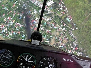
We now tour Central Luzon, best seen low and slow. Our ‘backyard’ is big enough to play in, small enough so that we can see it all on a full tank of avgas.
If you know how to find your way around, that is. We did promise to share the secret of how pilots REALLY find their way… .
Concepcion, Tarlac, is the birthplace of Ninoy Aquino, the martyr assasinated at what is now the Ninoy Aquino International Airport in Manila.

Exactly 10 miles from Clark, Concepcion is the northern VFR reporting point when entering or leaving the Clark control zone.
When you aren’t sure where you are, you fly low over a town — the name will probably be painted on a school or municipal hall’s rooftop 🙂

It sure is nice of this municipality to identify itself to pilots!
Zaragosa is the second waypoint in the 90-mile “outpattern” navigational training route of Omni Aviation. There are no roads from Concepcion, the first waypoint, to Zaragosa. So cheating via IFR (“I Follow the Road”) won’t work for student pilots — they need to learn real pilotage. And navigating to Zaragosa is key to flying the remaining 6 waypoints in the maze.
Mexico, Pampanga, the fifth waypoint, is almost impossible to miss. Someone with an airdale’s pizazz has painted the roof of his warehouse like the national flag of…

… You guessed it — Mexico! Can you see it? 🙂
Central Luzon is a rice granary — this is where nearly all our domestic rice is planted and harvested. Below, San Roque, halfway between Gapan, Nueva Ecija, and San Miguel, Bulacan, is surrounded by bountiful rice fields ready for harvest.

San Roque. The diagonal feature is an abandoned railway.
We’ve flown over the rice fields and fish ponds when they are emerald green and rich with treasure at harvest time…

Tarlac-Subic highway construction, at Concepcion
… When they are furrowed and parched in summer …

Haystacks and plowed fields, near Cabanatuan
… When they are fertile and planted with seedlings …

Newly planted ricefields, near Magalang, Pampanga
… And when they are pitifully submerged by typhoons.

Flooded rice fields, near Mt. Arayat
The typhoon season ravages Luzon just before harvest time, and it is heartbreaking to fly over fields flush and bursting with grain one week, and then see them completely submerged and ruined the next week. Water everywhere, as far as the eye can see.
I flew with Jaime U., a professional photographer, and he took these pictures of the same river I flew over just a week later. Rural serenity one week, …


… Widespread calamity the next 😦

We love flying over the waterways of Central Luzon. The fishermen on the pencil-thin bancas never fail to wave.


Mt. Arayat, an extinct volcano 3,100 feet high, stands sentinel over the plain. In the 1950’s the Hukbalahap communist guerrilla movement owned all of Mt. Arayat.

Today they probably own most of the surrounding countryside as well 🙂
In the southern shadow of Mt. Arayat is the town of Arayat, Pampanga.

I often see religious processions when I fly over Arayat on Sundays.

There is a weir on the river, near Arayat. Irrigation control.

Near San Fernando, Pampanga, is the small hill where they hold crucifixions, on Good Friday. I took this picture a couple of years ago. The crosses are on the round, barren hill.

The picture was taken from about 1,500 feet. That’s near enough. I’m not sure I ever want to see a real crucifixion up close.
To be concluded — Ben Hur’s aviation farm, ultralights and what was once the most secret airbase in the Philippines.
.
.

Thank you for your comments about my “Flour Bombing” story in Flying Magazine. Best of luck to you in your flying…and life!
Martha
LikeLike
Martha! Good heavens, is it really you?!
Thanks for visiting Flying in Crosswinds.
Carlo and I really enjoyed that “Flour Bombing” story. I was leaving home on a business trip when I read that. I went through a rainbow of emotions — homesickness, chortling laughter, agonized grief — as I boarded the airliner, started on your article, and got to the end.
And I am thoroughly enjoying the fact that you visited here 🙂 Write again soon, please.
Tonet
LikeLike
Im an American living in Sta. Lucia Resettlement close to Magalang, Pampanga. Happened to find your beautiful photos on the internet. Mt. Arayat, one of my favorite places, you captured in all its spender. All the other photos of the area are great too!!! Keep up the good work and if you have any extra photos please email them to me…
Thanks,
Gene Davis
LikeLike
Hi Gene,
First of all thanks for dropping by Flying in Crosswinds. And for taking the time to write a comment.
I too never get tired of flying around the Arayat area. It really is Carlo’s and my backyard. Like any backyard, there are our favorite spots, our familiar nooks, and the dark crannies where we don’t like to hang out so much.
Magalang is close to where the Angeles City Flying Club is, and is the standard waypoint for light aircraft exiting the Clark aerodrome traffic zone. We must have flown over you many times.
Are you a pilot? Wanna see your place from the air? Send me an email at tonet.rivera@bms.com, and we can get in touch the next time I’m at Omni Aviation.
🙂
Tonet
.
LikeLike
Hi Tonet,
thanks for posting this nice picts .. it was very helpful to me now because im using ur photos for my powerpoint presentation regarding landforms for grade2 and its easy for me to use this no problems at all .. anyways godbless u ..ingat lagi here in phils ..
LikeLike
Hi Rio,
Glad the pictures were of help to you. Just acknowledge the ownership because all pictures here (actually even the text) is copyrighted, and not all of them are mine- some are Carlo’s, or were taken by our passengers and used here with their permission.
Are you the one in Grade 2 or are you teaching Grade 2?
Thanks for visiting the blog!
🙂
LikeLike
hi!
I am loren of alay bayan, inc. i grabbed some of your photos posted in this site for our profiling. My office is a community-based disaster management institution in Central Luzon and we do area profiling. Can we request an aerial shot of the arnedo dike in Barangay Cupang Arayat Pampanga which poses a threat to some of the town’s villages?
Thank you in advance
LikeLike
Hi Loren,
Thanks for visiting Flying in Crosswinds. Some of the photos in the blog were taken by my son, and we copyright all content here. Just make sure you attribute the authorship whenever you use the images in publications or public displays, to protect yourself from copyright violations.
I’ll try and take a picture of the area you want. I live in Bangkok and work in Asia and Europe, but I’ll be in Manila this weekend. The airplane is based in Omni Aviation at Clark. Carlo lives in Manila, and if we cannot fly this weekend due to weather then I will ask him to try again the following weekends.
We need more information on the location. I know Arayat is the town southeast of Mt Arayat itself, and I’ve seen an irrigation canal and a weir, or small dam, there. But aviation charts don’t show details like “Arnedo dike” or “Barangay Cupang”, and I don’t want to take pictures of the wrong place. You can see a large area from an airplane, even flying low, and we need to find your target more precisely.
Even a small sketch would help.
Cheers!
Tonet
LikeLike
Dear Tonet,
Hi, my name is christine dayrit, a travel writer for the philippine star. i tried the ultra light plane at clark flying club last weekend and will be doing an article about my experience. i saw your beautiful aerial photos with mt pinatubo and the green fields taken below.may i please ask your permission to use these 2 photos for my column in the star this sunday?
will give you photo credits for your beautiful pictures if ok with you.
thanks so much. God bless
christine
LikeLike
Hi Christine, thanks for visiting Flying In Crosswinds. Yes, please go ahead and use the photos. Yes, credits would be good.
I have higher resolution originals if you want them. But, you have to help me because there are no pictures of Mt. Pinatubo on this article! Did you mean Mt. Arayat?
Or did you mean the ones in the article entitled, “Mt. Pinatubo, Zambales“?
Also, on Wed Sep 24 Carlo and I may fly at Clark. I will leave that evening for Bangkok, and won’t be back for a month. If you want to come along to take pictures of Pinatubo or anything else, send a text message to +63.917.8132505.
The weather should be good, because the typhoon to the east would have swept all the haze away.
Cheers!
.
LikeLike
Hi, my name is Nils from Sweden and Pilot.
I have an airfild Hornlanda http://www.flygkartan.se/0148556/Hornlanda
And find your beautiful photos on the internet
LikeLike